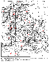
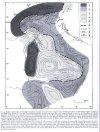
The deep crustal structure of Italy and surrounding areas from seismic refraction data.
A new synthesis.
IN MEMORIAM: Salvatore Scarascia (1926-2002)
by Roberto Cassinis, November 2002
------------------------------
As early as the late forties Dr. S.Scarascia has been engaged in geophysical prospecting, leading several projects of exploration aimed at different objectives and using nearly all geophysical methods and techniques. Since 1970 up to his retirement (1998) Dr. Scarascia worked in the "Institute for the Geophysics of the Lithosphere", National Research Council of Italy (CNR), successively serving as Researcher, Senior Researcher and Director of the Institute. Though being an expert of the acquisition, processing and interpretation of several data sets, during his later career he became particularly interested in seismic techniques applied to the exploration of the deep crust and upper mantle (DSS); in this field Scarascia gave an outstanding contribution to the interpretation procedures. He participated in the field work as well as in the processing phase of the projects carried out in Italy and in other European Countries under the sponsorship of the European Seismological Commission. Also after the retirement he continued the work of interpretation for the Central Mediterranean area and for the Alpine range, giving a further contribution to the knowledge of the structure of the deep crust in that region. Dr. Scarascia was a very competent researcher and a very capable and patient instructor of young researchers and students. At the same time he had the quality of being modest.
Salvatore will be deeply mourned by his many friends and admirers.
------------------------------
(*)
Formerly at the University of Milan, It. Corresponding Author: 30, V.le Lombardia, I-20131 - E-mail: roberto.cassinis@infinito.it
(**)
Formerly at IRRS-CNR, Milan, It.
(***)
Earth Sciences Dept., Geophysical Division, Univ. of Milan, It.


Redrawn after:
Cassinis R., Scarascia S., Lozej A., 2003.
The deep crustal structure of Italy and surrounding areas from seismic refraction data. A new synthesis.
Boll. Soc. Geol. Italiana, 122 (2003), 365-376.